Key findings
- Dissolved oxygen and nutrient concentrations were key predictors of macroinvertebrate populations in the Pinios basin.
- Multiple stressor combinations of dissolved oxygen and nitrate can have an antagonistic impact, whilst combinations of water temperature and dissolved oxygen can have a synergistic impact.
- Climate models project an increase in both precipitation and runoff around 2030, compared to the present day, and a subsequent decrease around 2060.
- Management measures to ensure sustainable water flows may be ineffective under future projected climatic changes.
Water management issues
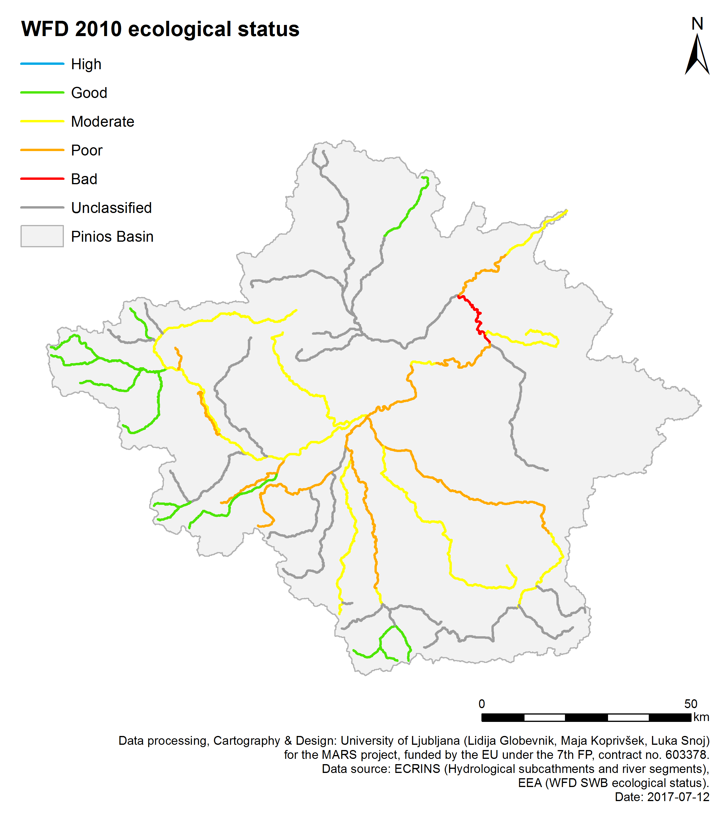
The overexploitation of water supplies through abstraction, hydrological alterations, hydromorphological alterations and the construction of dams, barriers and locks are key pressures in the Pinios basin, largely driven by agricultural activities and climatic drivers. The quantitative status of water (i.e. quantity) in the basin is poor in southern and central regions dominated by agriculture, whilst qualitative status (i.e. ecological status) is moderate across much of the basin. The key ecosystem services provided to humans by the Pinios basin are the provision of drinking water and irrigation water.
As a result of anthropogenic pressures, river flows may become low or intermittent in summer months, and small lakes and reservoirs may experience low levels, or even dry out. Unsustainable groundwater abstraction for irrigation is a widespread pressure, and many aquifers in the basin have extremely low water tables as a result. Around a fifth of the basin is cropland, which is irrigated each dry period (May to September) with water extracted mostly from groundwater resources (estimated to be ~800 × 106 m3 annually). The technical requirements for deep pumping of groundwater are expensive, and may experience saline intrusions of sea water in coastal areas. In addition, diffuse nutrient pollution as a result of intensive fertilisation is another important pressure (the Pinios is a Nitrate Vulnerable Zone), particularly when water levels are low.
Environmental storylines and scenarios
The MARS study in the Pinios basin sought to understand how the multiple stress or combination of water abstraction and nutrient pollution impacts on basin’s water quantity and quality, its ecological status, and the ecosystem services it can provide. This was modelled at present conditions, and forecasted under three scenario storyline conditions. This was undertaken using the MARS scenarios, which forecast environmental changes in the context of three storylines describing future political, economic, social and climatic changes, modelled in ten year periods around 2030 and 2060, alongside a baseline period 1995-2005. Each scenario incorporates a different climate model based on Representative Concentration Pathways 4.5 and 8.5, modelling alterations to temperature and precipitation.
Each scenario was developed through communication with basin stakeholders. Fragmented World frames a global situation where countries have little regard for environmental protection; both irrigation and fertiliser use increase in the basin; climate change is significant (RCP 8.5). Consensus World has economic growth and environmental protections similar to present day; climate change is moderate (RCP 4.5). In Techno World, economic growth is prioritised and environmental management is typically ad hoc, and focused on instrumental gains such as flood and drought protection; irrigation demand and fertiliser use increases and irrigation technologies improve; climate change is significant (RCP 8.5). The scenarios were each quantified in terms of changes in nitrate and phosphorous loading, and water levels under future conditions. Whilst each scenario is a broad-scale approximation, their use in modelling provides a range of possible future trajectories to inform management and policy decisions.
Results and conclusions
Multi-stressor interactions
Dissolved oxygen and nutrient concentrations were key predictors of macroinvertebrate populations, as measured by Average Score Per Taxon and EPT Indexes in the study. The most significant multiple stressor combinations varied depending on the metric used: dissolved oxygen and nitrate (for ASPT); and water temperature and dissolved oxygen (for EPT).
There is evidence that dissolved oxygen and nitrate have an antagonistic relation. Under low nitrate concentrations the positive effect of dissolved oxygen on ASPT is stronger than under higher nitrate concentrations. Similarly, it was shown that water temperature and dissolved oxygen have a synergistic effect on EPT. Under higher water temperatures the effect of dissolved oxygen on EPT is stronger than under lower water temperatures. However, overall the exact interaction types could not be defined.
Ecosystem services
Climate model projections of increased water availability at 2030 has a mostly positive effect on yields for both cotton and corn. Production of corn increases in Techno World, due to the significant increase of corn areas for biofuel production. The total water abstracted under almost all worlds and reference years (2030, 2060) also increases. The IPSL climate model is characterised by a more intense temporal variability of rainfall compared to the GFDL climate model, which projects extreme climatic events that decrease water storage, water availability and subsequent crop use.
Findings of scenario analysis
All scenarios show an increase of total precipitation around 2030, compared to the present day, and a subsequent decrease around 2060. The simulated runoff consistently follows the precipitation pattern. Temperatures increase under all scenarios to 2060. A sharp precipitation increase occurs in October for all the climate model runs. However, all the simulated runs predict lower precipitation during August in comparison to the baseline conditions. Overall, the climate scenarios predict an increase of annual precipitation, mostly during autumn, but very small changes (small increase or decrease) during the summer months.
Significance for water management
Water abstraction for irrigation is the main cause of poor quantitative status of water bodies within Pinios; while the fertilisation need is the main cause of nitrate pollution, which downgrades the qualitative status. There are several measures related to agriculture – either already in practice, other under negotiation or discussion – used in ‘Agricultural Best Management Practices - BMPs’. These include reduced and more targeted use of fertilisers and more efficient use of in-field water use. This may be achieved by upgrading the current inefficient irrigation methods and equipment – e.g. through deficit irrigation techniques and drip irrigation systems – in order to reduce water losses and reduce abstraction demands. Inter-basin water transfer and storage systems are also proposed, but can increase water stress in neighbouring basins, and create new hydromorphological pressures.
The findings of this study suggest that whilst management interventions are necessary, climate changes are likely to be the most significant drivers of water flows in the Pinios basin in the future. The climate models used in this work predicted an increase of annual precipitation in Pinios for the reporting period 2025-2035, mainly in the winter months. However, the situation is different for the period 2055-2065 where scenarios mostly predict a decrease in the river discharge. An increase of flood frequency and magnitude could have both beneficial and detrimental effects on aquatic ecosystems, depending on the channel morphology, type of substrate, depth and other hydromorphological characteristics. Significantly, climate effects in the future scenarios prevail over any effects generated by the management options in terms of the flow regime of the catchment. Management options may significantly reduce the water abstractions, but are projected to have only a small impact on changing surface runoff and river flows in a changing climate.
Basin overview
The Pinios river basin is located in Central Greece, in the Thessaly River Basin District. The catchment has an area of around 10,600 km², with hills and mountains in its north and northwestern areas, and flatter, agricultural land in the central and southern regions. The catchment is a key agricultural area in Greece, with fertile soils accompanied by dry summer climates which require high irrigation inputs of water. Cropland – for corn, alfalfa and cotton – covers around 20% of the catchment and is a significant cause of water stress due to its demands for surface and groundwater abstraction for irrigation.
Context for modelling
The process-based SWAT (Soil and Water Assessment Tool) model was used to model hydrologic and water quality processes and crop productivity. The SWAT model was calibrated using historic monthly river flows and seasonal nutrient dynamics. The model estimates the water balance components of the hydrologic cycle and, by considering pressures in the basin, links them with ecosystem services, simulating appropriately water abstractions from groundwater and reservoirs and crop productivity. The linkage between pressures and biotic indicators was also drawn through the use of empirical modelling consisted of boosted regression trees and general linear models. In this case, macroinvertebrate indicators were selected as biotic response to abiotic indicators. The latter were mostly provided by the SWAT model. The model outputs were brought together in the DPSIR (drivers, pressures, state, impacts, response) framework, which conceptualises how management actions may alter ecological status and ecosystem service provision in the basin.
Materials and methods
Precipitation, temperature and other meteorological variables were measured through point stations all across the Pinios basin from the Ministry of Environment and Climate Change & the Public Power Corporation. Water quality and biotic data was sampled from stations along the Pinios river. Digital elevation data was extracted from the NTUA’s Meteorological and Hydrological Database of Greece; land use data from Corine Land Cover 2000; and Farm Structure Survey (FSS) data and the soil layer from the Hydrolithological map of Greece and the Institute of Soil Mapping and Classification.
Facts and Figures: PINIOS
- Factors affecting measured runoff:
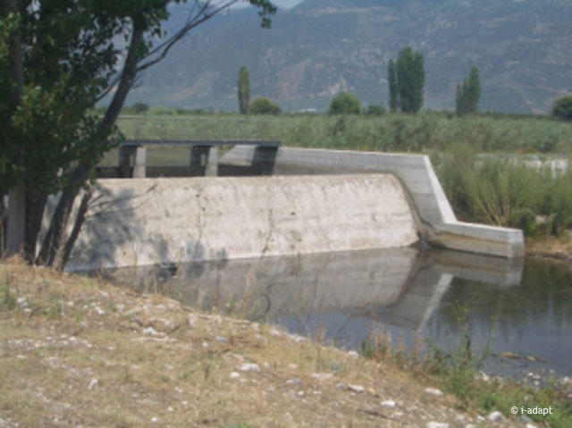
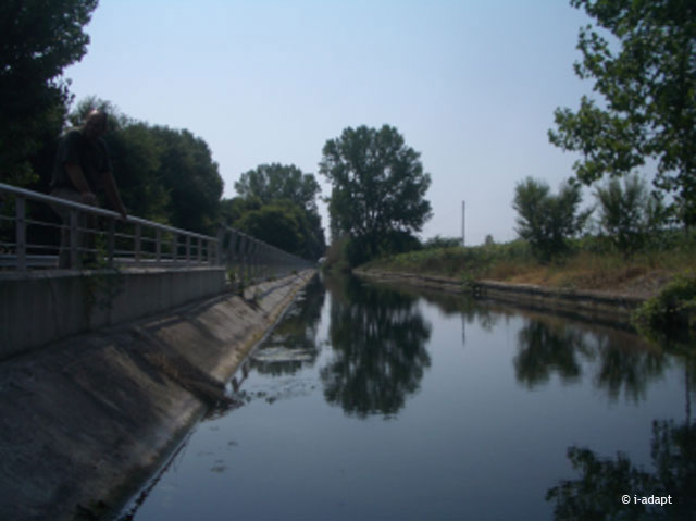
Water movement in the study area is a complicated process due to the large number of water exploitation (and extraction) sites such as the existing dams and reservoirs, and the pumping wells, which alter the natural drainage of the basin. The abstracted water for irrigation from the reservoirs causes irrigation runoff losses to occur from land to the stream network contributing to downstream flow. On the other hand, river flow all across the basin is reduced due to groundwater abstractions for irrigation that result in low groundwater height decreasing groundwater contribution to streamflow, while direct water abstractions from rivers and streams further decrease river flows, in some cases in unacceptably low levels. - Contact person: Yiannis Panagopoulos; National Technical University of Athens (NTUA)
Further reading
MARS Deliverables:
MARS (2017) Case study Pinios - Case Study Synthesis - Deliverable 4.1. (Download report, 26.1mb)
Scientific articles and reports:
Stefanidis K., Panagopoulos Y., Psomas A. & Mimikou M. (2016). Assessment of the natural flow regime in a Mediterranean river impacted from irrigated agriculture. Science of the Total Environment, Vol. 573, pp 1492–1502. DOI: 10.1016/j.scitotenv.2016.08.046 (Read abstract)
Stefanidis K., Panagopoulos Y. & Mimikou M. (2015). Impact assessment of agricultural driven stressors on benthic macroinvertebrates using simulated data. Science of the Total Environment, Vol. 540, pp 32-42. DOI: 10.1016/j.scitotenv.2015.08.015 (Read abstract)
Panagopoulos Y., Makropoulos C., Gkiokas A., Kossida M., Evangelou E., Lourmas G., Michas S., Tsadilas C., Papageorgiou S., Perleros V., Drakopoulou S. & Mimikou M. (2014). Assessing the cost-effectiveness of irrigation water management practices in water stressed agricultural catchments: the case of Pinios, Agricultural Water Management, Vol. 139, pp 31-42. DOI: 10.1016/j.agwat.2014.03.010 (Read abstract)
Panagopoulos Y., Makropoulos C., Kossida M. & Mimikou M. (2014). Optimal implementation of irrigation practices: a cost effective desertification action plan for Pinios.[nbsp]Journal of Water Resources Planning and Management, Vol. 140, Doi: 10.1061/(ASCE)WR.1943-5452.0000428 (Read abstract)
Websites:
Freshwater blog (2014). Meet the MARS team: Yiannis Panagopoulos (External website)
Makropoulos, C. & Mimikou, M. (2012). ‘i-adapt’: Innovative approaches to halt desertification in Pinios: Piloting emerging technologies – A monograph. School of Civil Engineering, National Technical University of Athens. (External website)
