Key findings
- Total phosphorous is the main stressor influencing algal growth in the Elbe basin, and phosphorous loadings originate largely from agricultural and waste water plant sources.
- Under a Consensus World scenario, similar to the present day with reduced fertiliser use, less meat consumption and improved waste water treatment, nutrient concentrations can be reduced to national target levels by 2050.
- An extensive implementation of woody buffer stripes would result in an improved ecological status for mid-sized rivers.
- The Middle Elbe basin has a significant natural denitrification cycle, particularly in the summer months, processing ~38,000–40,000 tonnes of nitrogen per year – a significant ecosystem service, calculated to be worth between €1932–2031 million per year.
Water management issues
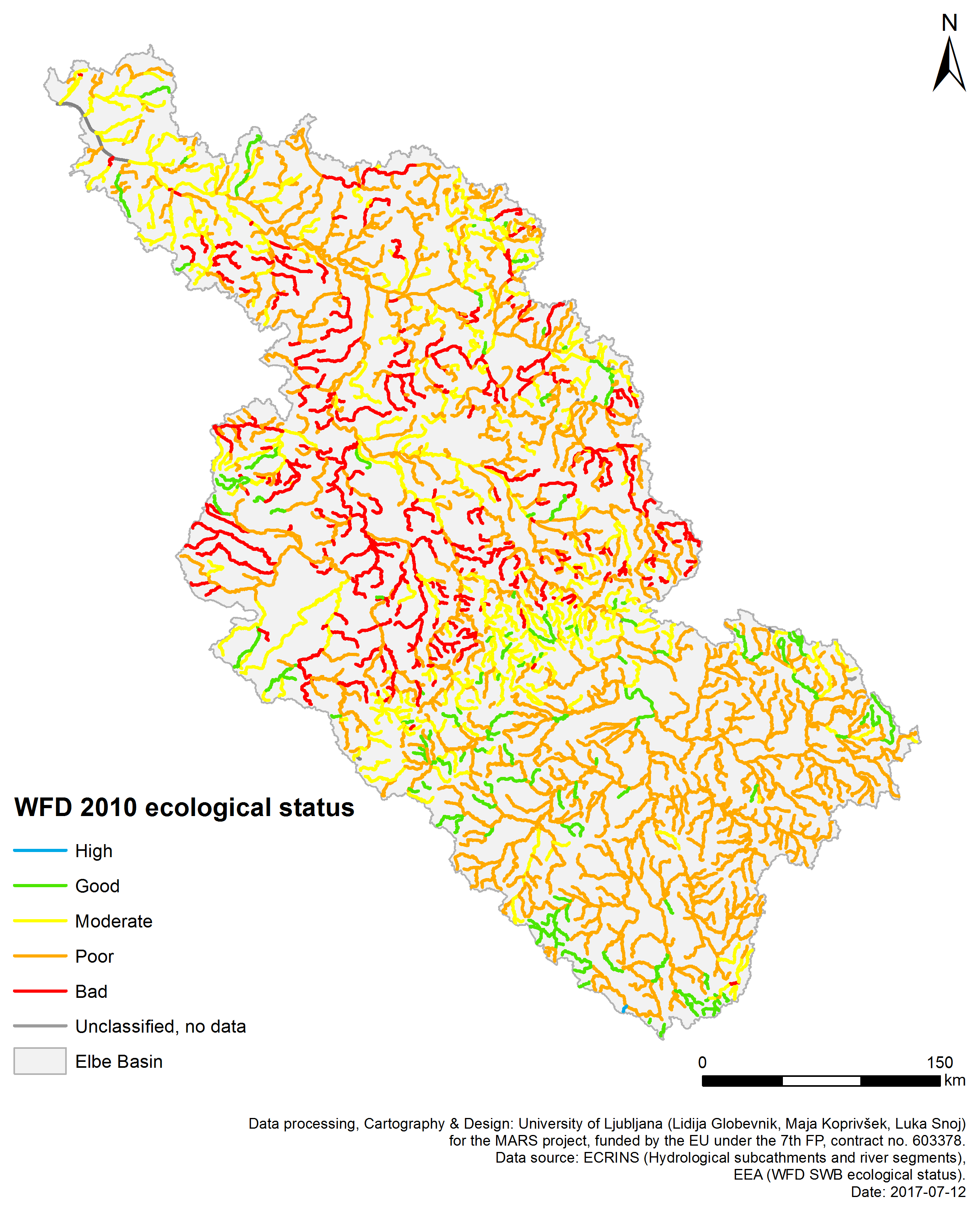
Good ecological status was identified in only 4.3% of the 2317 surface water bodies in the Middle Elbe basin, which was assessed in 2009 for the Water Framework Directive River Basin Management Plan (RMPL). Few changes were reported in the 2nd RMPL with 95% of rivers and 79% of lakes failing the good status.
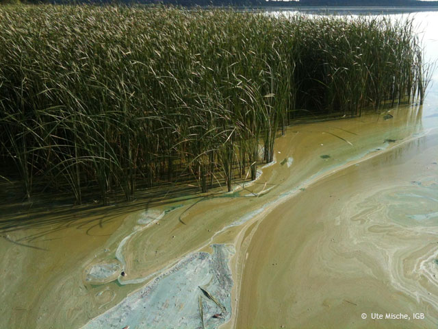
Eutrophication as a result of nutrient pollution from agriculture and urban waste water plants is a key pressure on the basin’s surface waters, and current nutrient loading into the basins waters is far above historical conditions. Diffuse pollution of agricultural run-off and chemical leaching from former mining activities are common across the basin. Nitrates are mainly emitted by diffuse pollution, whereas phosphates are mainly emitted by point source pollution.
The lowland Middle Elbe basin, characterised by low water availability and numerous connected, and often shallow, lakes is extremely sensitive to eutrophication. Currently, phytoplankton growth in most regions is limited by light (due to shading) rather than nutrient availability. In addition, around half of the Middle Elbe channel is classified as ‘heavily modified’ or ‘artificial’, as a result of widespread channel alterations and other hydro-morphological pressures. As a result, the Middle Elbe ecosystems are exposed to numerous multiple stressor combinations.
Environmental storylines and scenarios
The reduction of eutrophication is a key focus for water management in the Middle Elbe basin. Land use is an important driver of the diffuse pollutants which cause eutrophication. Mitigation strategies such as riparian vegetation planting are being proposed as a means of buffering diffuse pollutants, and shading light and heat from the river channel, thus potentially enhancing resilience to future climate changes.
The MARS modelling work in the Middle Elbe basin thus focused on the impacts of changing land use, nutrient emissions and water flows on the river ecosystem, taking into account multiple stressor interactions. Three ‘scenario’ analyses were used to assess the ecological impacts of future land use and management approaches. The MARS scenarios forecast environmental changes in the context of three storylines describing future political, economic, social and climatic changes, to 2025 and 2050 Techno World is characterised by the widespread overuse of natural resources, weak environmental protections and rising global temperatures. In Consensus World, natural resource use is broadly sustainable, environmental protections are maintained or improved, climate changes are weak to moderate. In Fragmented World, natural resource use is highly unsustainable, with a dependency on fossil fuels, weak environmental protections and significant climatic changes.
The implementation of the scenarios was shaped by regional climate trends and predictions of socio-economic patterns. In the German Elbe basin the total human population is demographically expected to decline by 17% with a shift from rural areas to cities (implemented for MARS Fragmented World). Strong migration of people from Europe to the basin is assumed in the MARS Techno World. Ecosystem service provision was estimated based on nutrient loadings and retention, and the comparative costs necessary to reduce nutrient levels with waste water plants, compared to natural reductions. Chlorophyll concentrations – which increase with eutrophication events – were also simulated, in relation to their effects on ecological status.
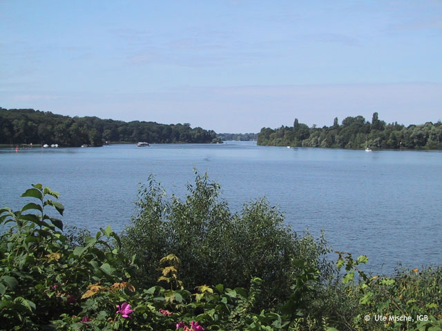
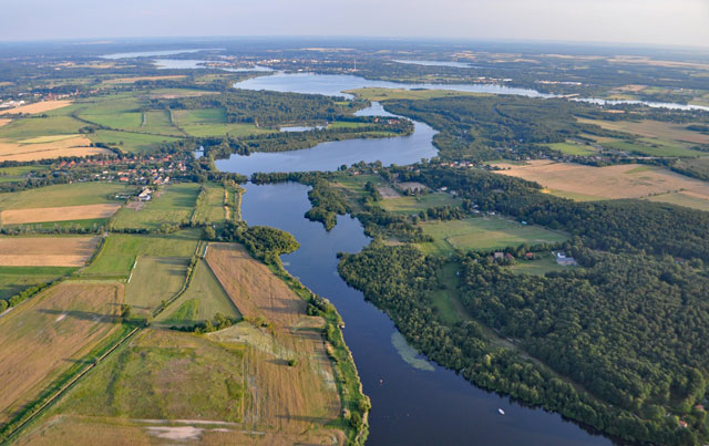
Havel river close to Berlin
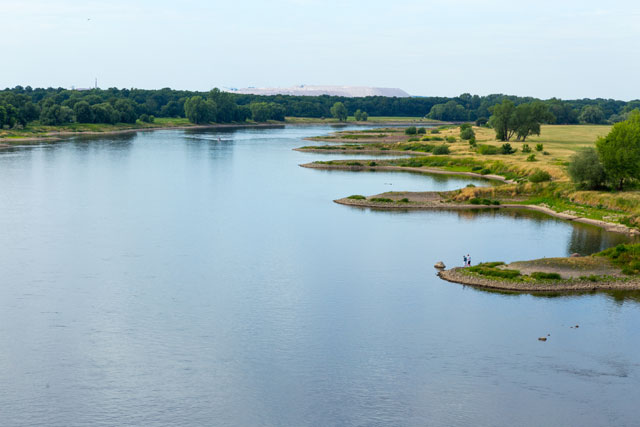
Elbe, with the Zielitz potash plant in the background
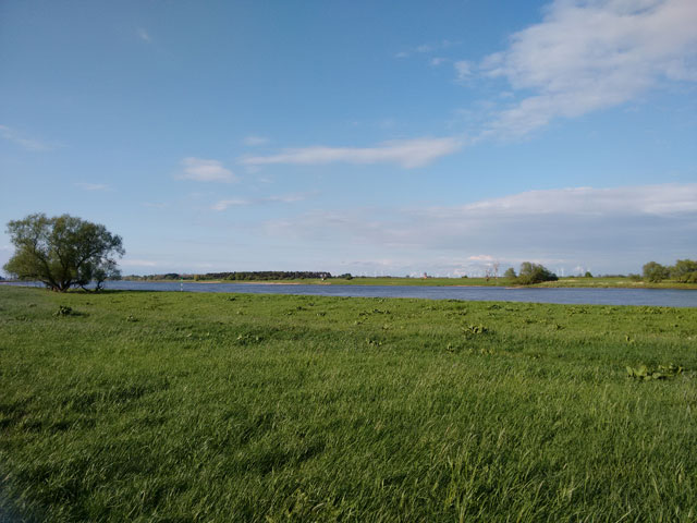
Elbe floodplains with extensive agriculture near Tangermünde
Results and conclusions
Multi-stressor interactions
Total phosphorous is the single stressor influencing algal growth, with no interactions detected with other stressors. Monitoring data and the MARS process-based model “PhytoBasinRisk” suggest that the physical and socio-economic conditions in the Middle Elbe encourage high phytoplankton biomass growth across the basin, within a wide range of discharge conditions. Any nutrient dilution caused by short term events such as floods or nutrient uptake by algae is rapidly compensated for in the river system by new nutrient inputs from the wider landscape. Any decline of phytoplankton populations caused by floods or nutrient depletion is rapidly compensated downstream by enhanced algal growth.
Scenario Analysis
Simulated Elbe basin run-offs in climatic change scenarios differ strongly between the two global climate models. The wettest long term mean (April-October) is simulated for GFDL around the year 2050 with the Representative Concentration Pathway (RCP) 8.5, and the driest projection is for IPSL around the year 2025 with RCP4.5. This factor highly impacted the modelling of nutrients and chlorophyll additionally to the common socio-economic projections for the MARS scenarios.
Modelled nutrient loads were highest in Fragmented World, and lowest in Consensus World. In Techno World, population growth was high, but environmental impacts were mitigated by technical upgrades to waste water treatment plants and food production. However, reductions in total phosphorous levels were not strong enough to limit mean seasonal growth of phytoplankton blooms. Significant reductions in nutrient concentrations were only observed in the Consensus World scenario. The lowest chlorophyll-a vegetation means were simulated for the main channel of the Elbe in the Consensus World storyline, but were still up to 30-40% above current levels in some months (April and September) in all climate IPSL future projections. Optimised river bank shading, as assumed in MARS Consensus World, would reduce algal growth in rivers smaller than 30m.
The Middle Elbe basin has a significant natural denitrification cycle, particularly in the summer months. The retention and cycling of nitrates (~38,000–40,000 tonnes per year) is a significant ecosystem service, calculated to be worth between €1932–2031 million per year. A similar range of denitrification rates is forecasted for all future scenarios because there are only minor changes to water temperatures and large floodplain areas in the middle reach of Elbe.
Significance for water management
The scenario analysis for Consensus World suggest that by year 2050, nutrient concentrations are reduced to current national target levels according to the EU Framework Directives for Water and for the Marine Strategy. This is achieved through the combined impact of reduced fertiliser applications, lowered meat consumption, and the use of flocculation treatments in all large waste water treatment plants to reduce phosphorous pollution.
Extensive implementation of woody buffer stripes along smaller tributaries in the Middle Elbe would help to mitigate eutrophication and chlorophyll growth, by limiting light and nutrients, resulting in an improved ecological status for mid-sized rivers. This positive effect would, however, in larger rivers be mostly compensated by reduced self-shading, and a more efficient use of available nutrients, so that the ecological status appears not to improve at the basin outlet. For the German part of the Elbe main channel, the impact of nutrient reduction measures varies with nutrients and phytoplankton entering the system from the upper part of the basin in the Czech Republic.
Basin overview
The Middle Elbe basin in Northern Germany covers an area of over 80,000 km2, draining around 20% of the country. Originating in the Czech Republic, the Elbe enters Germany south-east of Dresden, beginning its ‘Middle’ section which extends 585km to the Geesthacht dam upstream of Hamburg. The Middle Elbe basin includes two major lowland sub-basins, the Havel and Saale. The basin is dominated by arable agriculture (55.5%) and forests (30%). There are several large urban areas in the basin, including Berlin and Potsdam (Havel), Halle and Leipzig (Saale), and Dresden, Wittenberg and Magdeburg (Elbe), with a total population of 21 million people across the basin.
Context for modelling
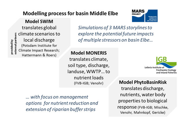
A statistic empirical model (EM Elbe) was developed to identify stressor interactions, using environmental and biological response data from monitoring stations, combined with landscape morphology and land-use data derived from common GIS maps, using a Water Framework Directive typology and status information to classify water bodies. Process-based models use dynamic climate input data (RCP), driven by two global climate models, ISI-MIP scenarios GFDL-ESM2M and IPSL-CM5A-LR, and fed into the SWIM hydrological model. Nutrient emissions and transformations and phytoplankton biomass were simulated by MONERIS and PhytoBasinRisk, using the discharge output from SWIM. The DPSIR (Drivers, Pressures, States, Impacts, Responses) model for the Middle Elbe describes how different land use and management actions may impact the ability of the basin to provide ecosystem services such as clean drinking water.
Materials and methods
The Middle Elbe is an extensively monitored, lowland basin. As a training data set for phytoplankton and nutrient modelling, high-resolution data covering 73 river water bodies for the period 2005-2010 was available from the German Federal States under cooperation with the River Basin Community Elbe (FGGE). This data was linked with GIS information for population, municipal waste water treatment plants, land use, slope soil type and river morphology and analytic units in a database.
Facts and Figures: ELBE - HAVEL - SAALE
Further reading
MARS Deliverables:
Mischke U., Mahnkopf J., Gericke A. & M. Venohr (2016). Simulation of the effect of riparian shading and nutrient reduction measures on phytoplankton in Middle Elbe basin (Germany), MARS Basin Report Middle Elbe, IGB, Version 2016/08/16. (Download report, 2.3mb)
MARS (2017) Case study Elbe, Havel, Saale - Case Study Synthesis - Deliverable 4.1. (Download report, 26.1mb)
Scientific articles and reports:
Hattermann F.F., Huang S. & Koch H. 2015. Climate change impacts on hydrology and water resources. Meteorologische Zeitschrift, Vol. 24, 2, 201–211. DOI: 10.1127/metz/2014/0575 (Download article, 663kb)
Kail J. & Wolter C. 2011. Analysis and evaluation of large-scale river restoration planning in Germany to better link river research and management. River Research and Applications 27: 985-999. DOI: 10.1002/rra.1382 (Read abstract)
Natho S.,Venohr M., Henle K. & Schulz-Zunkel K. 2013. Modelling nitrogen retention in floodplains with different degrees of degradation for three large rivers in Germany. Journal of Environmental Management 122:47-55. DOI: 10.1016/j.jenvman.2013.02.049 (Read abstract)
Venohr, M., Hirt, U., Hofmann, J., Opitz, D., Gericke, A., Wetzig, A., Natho, S., Neumann, F., Hürdler, J., Matranga, M., Mahnkopf, J., Gadegast, M., Behrendt, H., 2011. Modelling of nutrient emissions in river systems – MONERIS – methods and background. International Review of Hydrobiology 96 (5), 435–483.
Additional documents:
ICPER 2016. Flyer: The Elbe river and its basin (Download flyer, 4mb)
ICPER 2016. ICPER Information sheet: Water Framework Directive in the Elbe river basin (Download flyer, 4mb)
ICPER 2016. Flyer: International Commission for the Protection of the Elbe River (Download flyer, 4mb)
Websites:
Freshwaterblog (2017). Mutagenicity in surface waters: new insights into an old problem (External website)
Freshwaterblog (2016).Tracking the ecological recovery of German lakes following eutrophication (External website)
